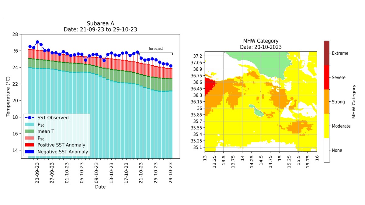
The STREAM project funded by the MCST Space Research Fund and conducted by MCAST as leader, MST Audiovisual Ltd and THINK Ltd, is operationally delivering daily analysis of satellite-derived data to monitor events of extreme sea surface temperature. The first figure shows how the sea temperature around the Maltese Islands remained at around 26 degC for the last 30 days, warmer by about 1.5 degC with respect to the expected climatological levels. This has practically led to a long enduring marine heat wave, putting the marine ecosystem under stress for such an extended period of time. The peak anomaly was registered yesterday (Friday 20th October) when the average sea temperature at 26.2 degC was more than 2 degC higher than the expected historical mean. Temperature patterns vary from one site to another.The STREAM service also gives a daily spatial map of the situation. The second figure shows the most impacted areas in the Malta shelf area on 20th October, by categorising MHW levels in the vicinity of the Maltese Islands, that remained moderate in our coastal seas as compared to severe intensification to the west.It is not surprising that our beaches are still full of umbrellas and swimmers still enjoying an extended summer …..but the forecast for the next 10 days is a gradual lowering of the temperature to around 25 degC which will however still be higher than the historical mean.


