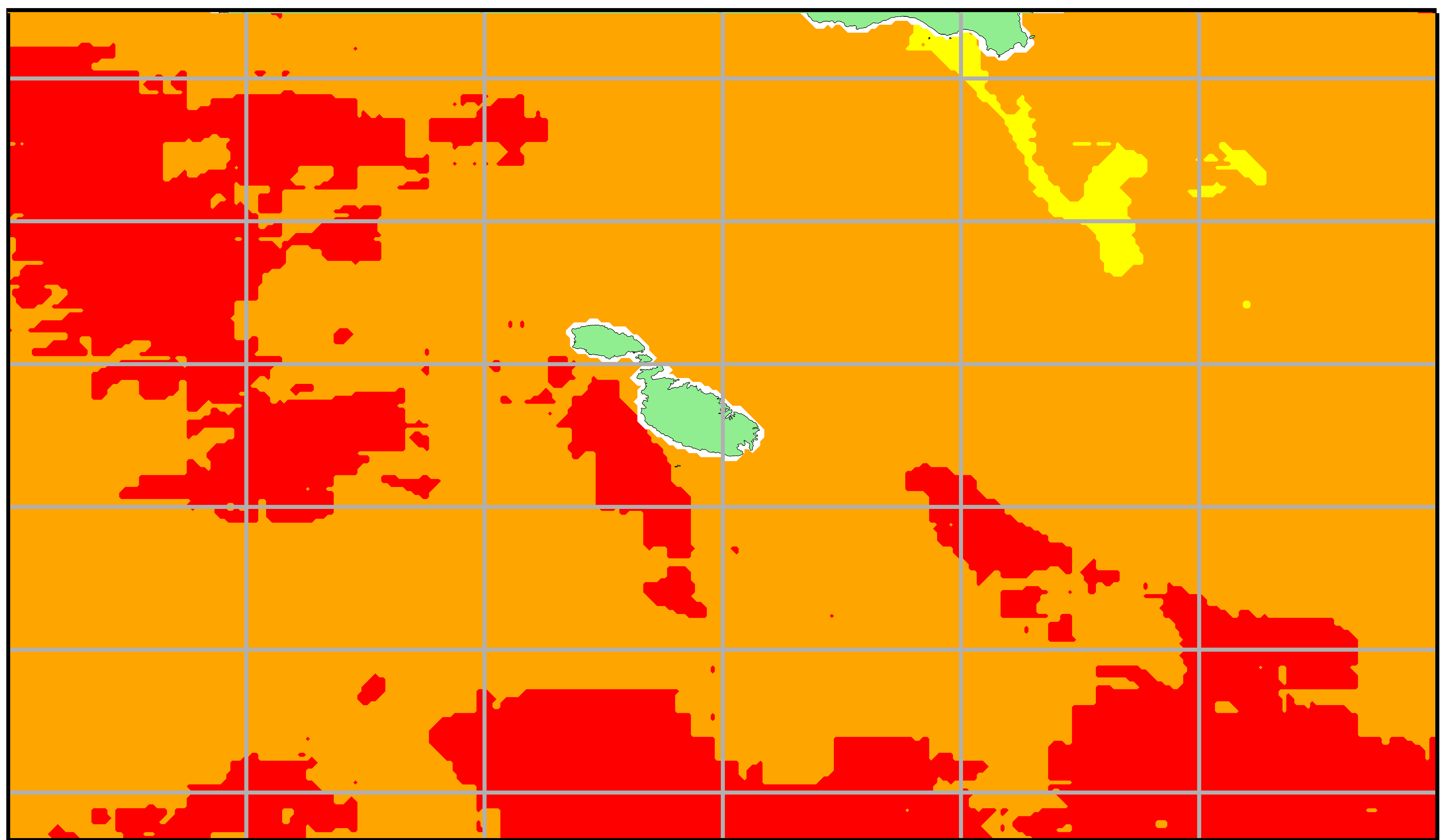
The STREAM project led by MCAST has been following the high sea surface temperatures (SST) experienced around the Maltese Islands in July. The project delivers specialised analysis of satellite data in the form of operational maps describing the intensity and duration of abnormal sea temperatures.
A marine heat wave (MHW) is defined as a period during which the sea temperature is abnormally warm for the time of the year relative to historical temperatures, with that extreme warmth persisting for at least five consecutive days.
Satellite SST is measured at midnight. At daytime the temperature is expected to be about 1 DegC higher. Figure 1 shows the evolution of the observed SST in the last 30 days averaged for a coastal strip around the Maltese Islands. The 90th percentile shows the expected variability. A MHW occurs when the SST anomaly exceeds this margin of variability. The MHW persisted for 17 days with a peak on Monday 24th July, after which the temperature decreased rapidly over the next three days.

MHWs are categorised according to the extent of the anomaly with respect to the climatological variability. Figure 2 shows the spatial extent of the MHW on 24th July which ranged from strong to severe conditions around the Maltese Islands.
STREAM will be soon providing this service in forecast mode through the use of numerical models.

