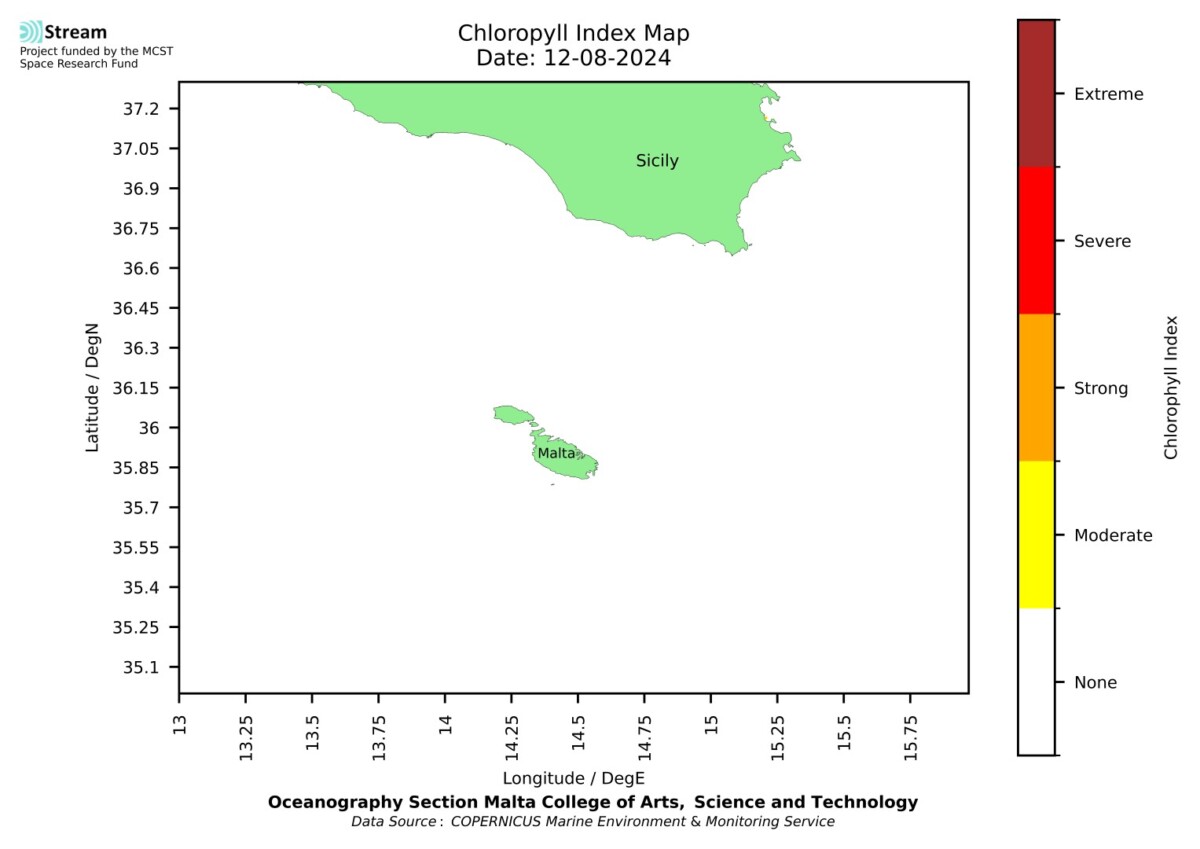
Spatial map of high chlorophyll occurrence and intensity. The CHL index is signalled when the CHL anomaly (CHLA) exceeds the CHL 90th percentile (CHL90) for at least 5 consecutive days. The CHL index gives a measure of the chlorophyll intensity, measured by the size of the CHLA compared to the difference between CHL90 and the climatological mean CHL.
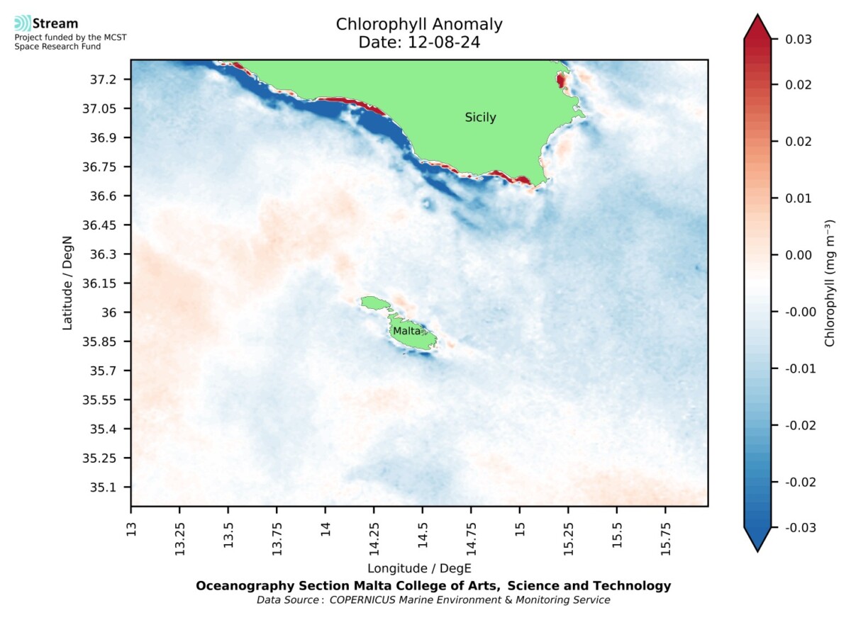
Map of the sea surface chlorophyll-a anomaly (CHLA = difference of the satellite observed CHL concentration with respect to the climatological mean). The climatology is calculated over 26 years (Sept1997 – Aug2023) using the 1 Km gap-free daily CMEMS dataset from multi-sensor (SeaStar-SeaWiFS, AQUA-MODIS, NOAA20-VIIRS, NPP-VIIRS, Envisat-MERIS and Sentinel3A-OLCI) Rrs spectra and the updated the MedOC4 algorithm for Case 1 (off-shore) waters, and AD4 for Case 2 (coastal) waters.
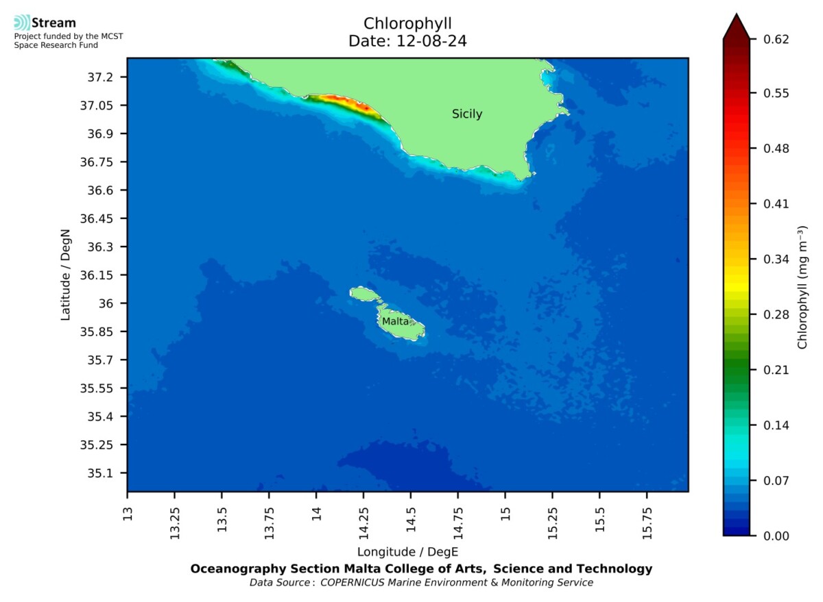
Synoptic map of the sea surface chlorophyll-a (CHL) measured by satellite. Source: OCEANCOLOUR_MED_BGC_L4_MY_009_144 using the multi-sensor, multi water-type, interpolated Chlorophyll a concentration daily gap-free dataset: cmems_obs-oc_med_bgc-plankton_my_l4-gapfree-multi-1km_P1D
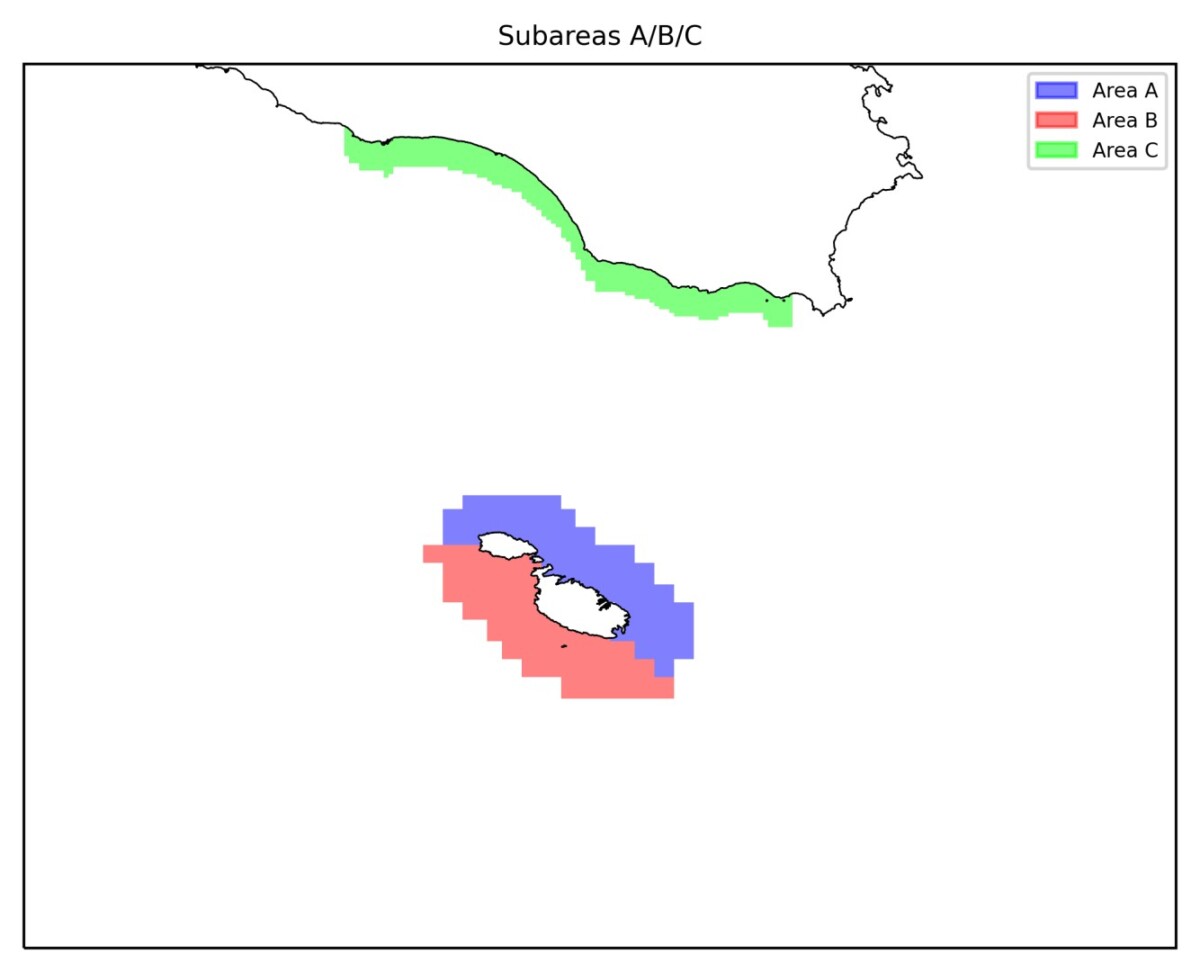
Select subarea for viewing synopsis and statistics
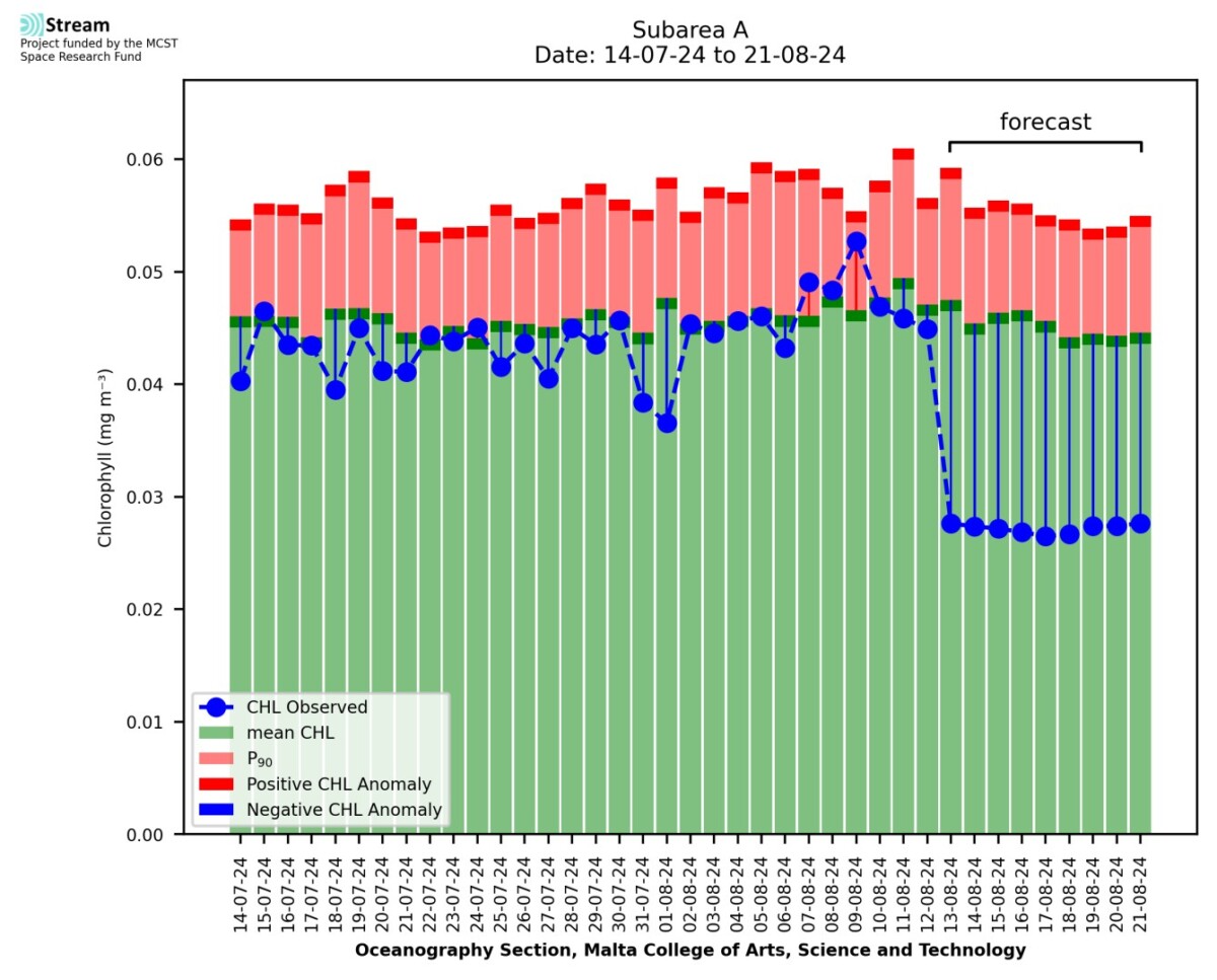
Time series of daily satellite CHL concentration values for a period before the chosen day, and 9 days of forecast issued on the chosen day (centred at mid-day). Values are domain averages for the selected sub-area.
Area A
Domain-averaged CHL statistics (mg/mm3) for the chosen day and sub-area.
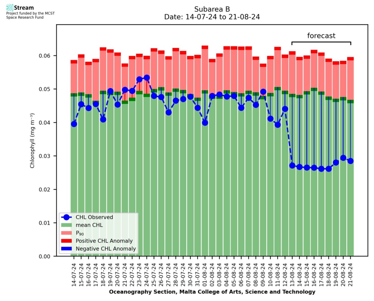
Time series of daily SST values for a period before the chosen day, and 9 days of forecast issued on the chosen day. Values are domain averages for the selected sub-area.
Area B
Domain-averaged CHL statistics (mg/mm3) for the chosen day and sub-area.
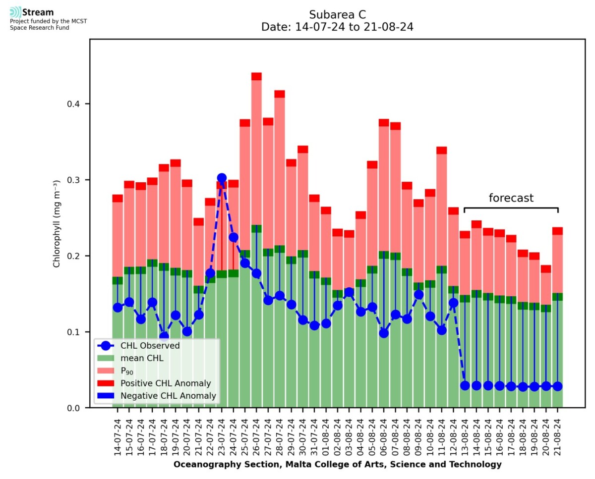
Time series of daily satellite CHL concentration values for a period before the chosen day, and 9 days of forecast issued on the chosen day (centred at mid-day). Values are domain averages for the selected sub-area.
Area C
Domain-averaged CHL statistics (mg/mm3) for the chosen day and sub-area.
The STREAM project partners make every effort to ensure that information contained in these pages is accurate and up to date. However, the STREAM partners do not accept any liability and/or responsibility for the reliance placed by the users of these pages on the information contained in these pages or any other information accessed via this web page. The information provided in these pages is provided on an “as is” basis, and no warranties of any kind are issued whether expressly or implied by the STREAM partners on the information provided.
The STREAM project partners make every effort to ensure that information contained in these pages is accurate and up to date. However, the STREAM partners do not accept any liability and/or responsibility for the reliance placed by the users of these pages on the information contained in these pages or any other information accessed via this web page. The information provided in these pages is provided on an “as is” basis, and no warranties of any kind are issued whether expressly or implied by the STREAM partners on the information provided.
The STREAM project partners make every effort to ensure that information contained in these pages is accurate and up to date. However, the STREAM partners do not accept any liability and/or responsibility for the reliance placed by the users of these pages on the information contained in these pages or any other information accessed via this web page. The information provided in these pages is provided on an “as is” basis, and no warranties of any kind are issued whether expressly or implied by the STREAM partners on the information provided.
